
 Tijuana River Watershed
 Los Laureles Canyon (Site in Red)
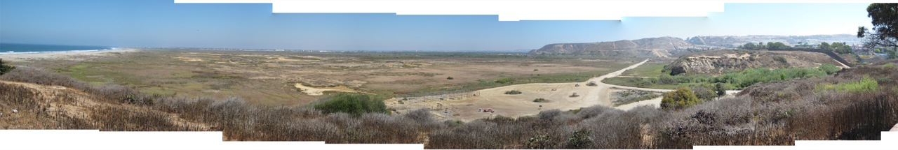 Tijuana River Estuary, Pacific Ocean on the left, Los Laureles Canyon on the right
The problem is that development pressures on the Los Laureles Canyon have created a situation in which sewer, trash, and soil are rolling down the canyon, altering the Estuary's fragile salt marshes (seen above) and ecosystem.
 However, solving this problem becomes harder as the border is currently a political football with the calls for 'closed borders' translating into projects that further damage ecosystems and discourage cross-border solutions.
Army Corps of Engineers Sewer Project on the Border (border fence in black)
 This project is two unite two hills so that border patrol does not have to drive up and down. The problem is that they are creating a dam that can cause sewer floods on the Mexican side, perhaps worsening the environmental condition of the canyon.
No comments:
Post a Comment